Choices 1 and 2
These parcels are closest to bus routes and sit at the edge of Alton Baker Park. Their location could support a smaller service facility or a program connected with job skills and community service.
Using ArcGIS Pro to identify and compare potential locations for homelessness service facilities in the Eugene–Springfield metropolitan area.
This project applied spatial analysis and cartographic design to a practical public-service question: where could new homelessness service facilities be located?
Publicly owned, vacant parcels considered available for development were screened for suitability. The resulting sites were then compared using neighborhood context, access to bus stops, proximity to existing facilities and parks, parcel size, and land value. Poverty rates were mapped to help show areas of potential need.
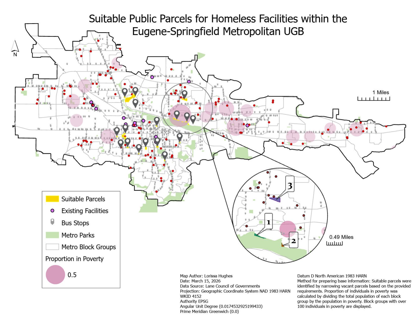
The first layout shows 20 candidate parcels across the Eugene–Springfield metropolitan urban growth boundary. It places those parcels alongside bus stops, existing facilities, parks, and the share of residents in poverty by block group.
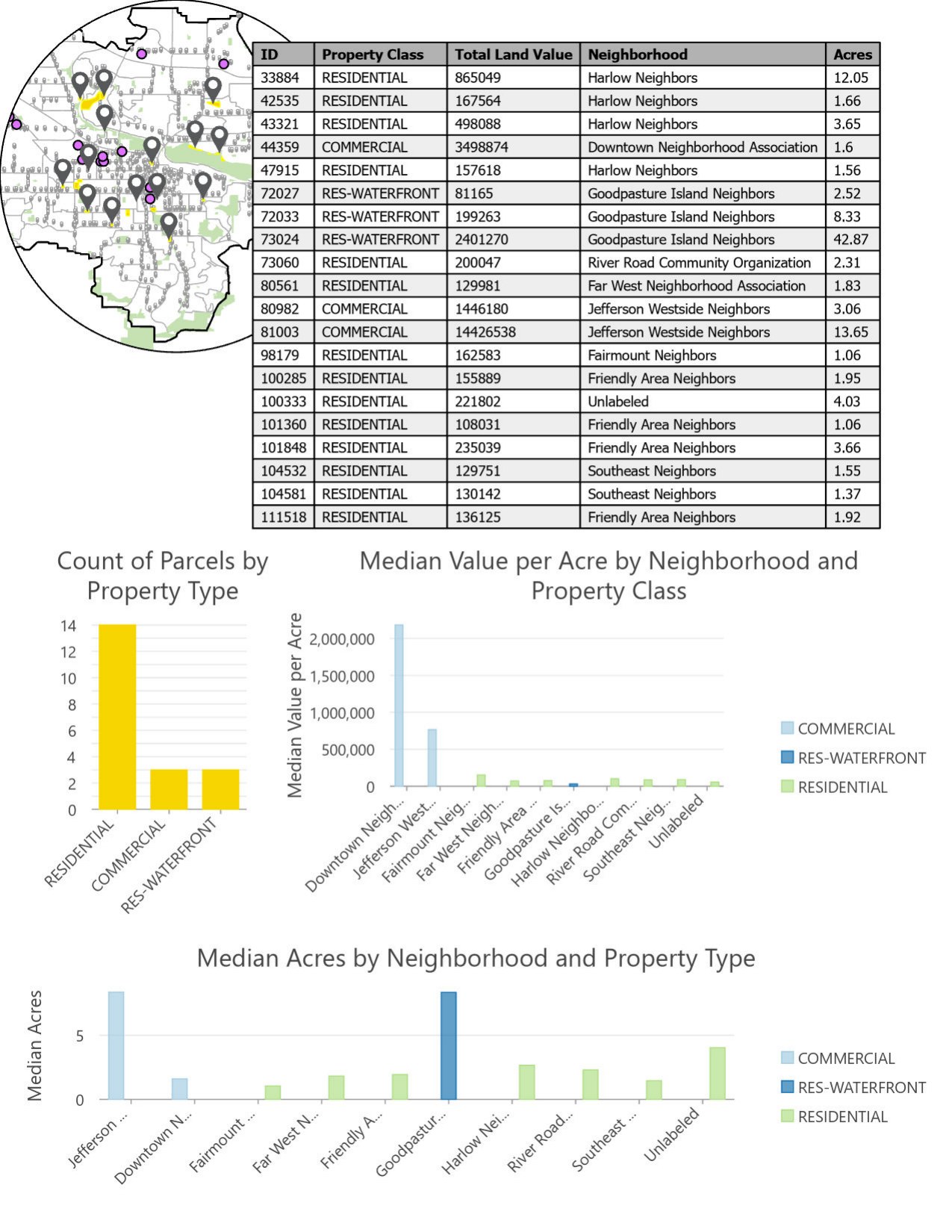
An attribute table and summary charts compare the 20 parcels by property class, neighborhood, total land value, value per acre, and acreage. Most of the candidates were residential parcels, while the full set ranged from just over one acre to nearly 43 acres.
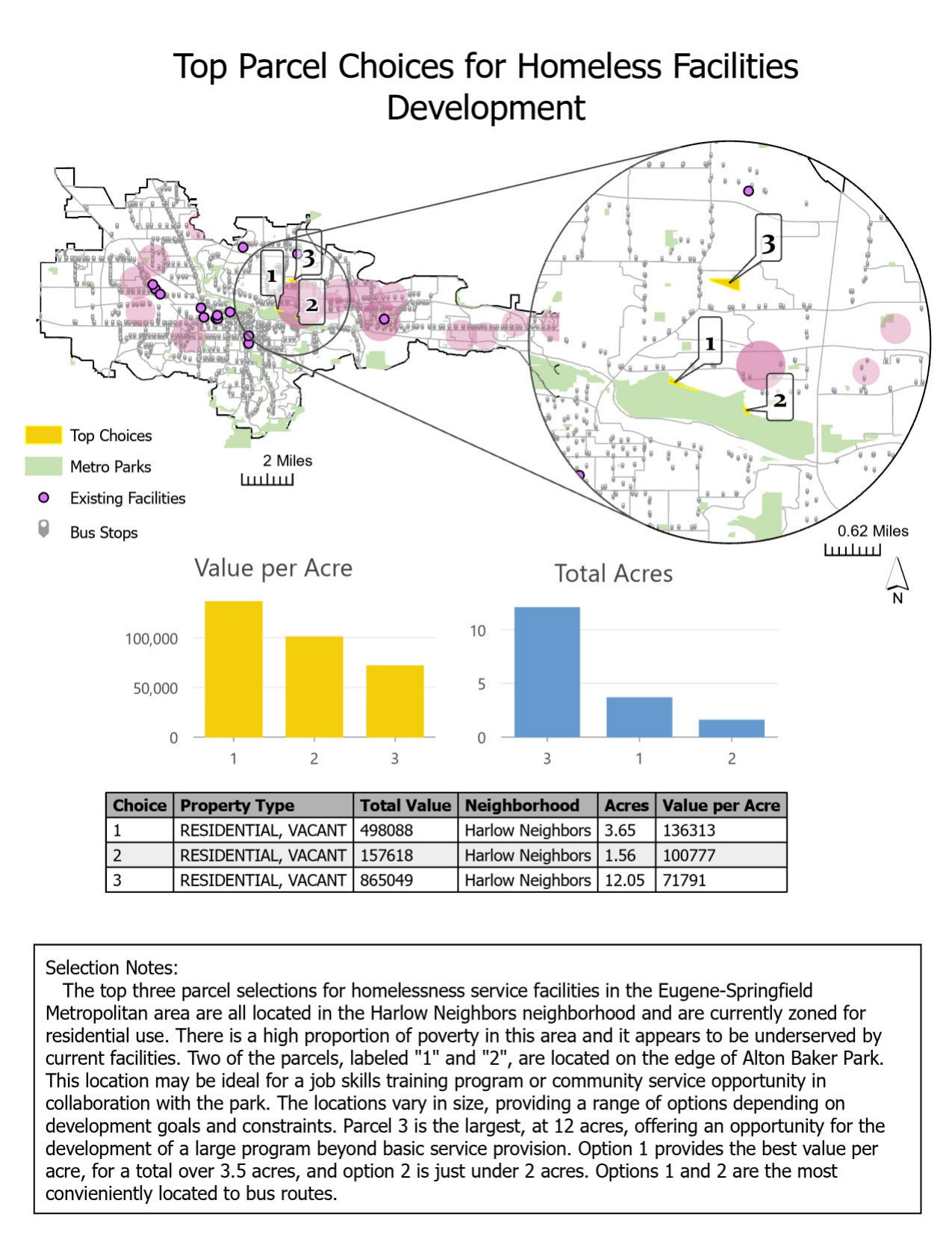
The final recommendation narrowed the candidates to three vacant residential parcels in the Harlow Neighbors area. The sites offered different tradeoffs between size, value, transit access, and proximity to Alton Baker Park.
| Choice | Acres | Total value | Value per acre |
|---|---|---|---|
| 1 | 3.65 | $498,088 | $136,313 |
| 2 | 1.56 | $157,618 | $100,777 |
| 3 | 12.05 | $865,049 | $71,791 |
These parcels are closest to bus routes and sit at the edge of Alton Baker Park. Their location could support a smaller service facility or a program connected with job skills and community service.
At 12.05 acres, this was the largest finalist and had the lowest value per acre. Its size could accommodate a broader program beyond basic service provision.